Norwich earns accreditation from United States Geospatial Intelligence Foundation
Norwich adds another career-driven pathway for student education.
Much like Captain Alden Partridge, today’s Norwich University faculty are committed to ensuring that the Norwich system of education pushes boundaries forward. The recent accreditation of the University’s undergraduate certificate program in Geospatial Intelligence (GEOINT) by the United States Geospatial Intelligence Foundation (USGIF) highlights that fact.
“I’ve been using and abusing geospatial intelligence ever since we had the tools and toys necessary to make it work,” says Bruce Dobbins, a retired naval intelligence officer, adjunct professor in the School of Criminal Justice and Criminology, and now geospatial intelligence coordinator at the Peace and War Center. “Have you used GPS recently? Congratulations, you were using geospatial intelligence.”
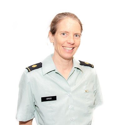
Though Dobbins has extensive experience in GEOINT through his time serving in the Navy, his expertise is paired alongside that of Dr. Travis Morris, director of the Peace and War Center, and Dr. Laurie Grigg, chair of the Department of Earth and Environmental Sciences. “Travis approached me about working on a project that basically increased our curriculum around various data and analytical methodologies,” says Grigg. “He asked me to work on the geospatial part of it because I’m the one at the University who has been teaching it and has developed a class on it.”
At the time, Morris was the director of the School of Criminal Justice and Criminology and was looking at criminal intelligence when he realized he wanted to expand with ArcGIS. “I started working with Laurie on how we get into GEOINT,” he says. “Laurie started doing some investigations into this certificate. This is not my area — I understand what this domain produces, but I’m not an operator in this space. She’s an operator in ArcGIS.”
The pair was working on a host of programs and saw a gap where they were missing someone with the background and expertise between the two of them. “Then Bruce started teaching for Norwich. I think his first course was something like criminology — but it wasn’t this,” says Morris. “Someone mentioned that this new adjunct professor has a background in naval intelligence. We had a conversation and he talked about the things he did, and mentioned initiatives and other courses he’s taught, like intel courses. We just sort of married that.”
Dobbins’s current position falls under the John and Mary Frances Peace and War Center. “Travis knew of my credentials and recruited me to help develop the geospatial program. The fact that I was retiring here to Vermont was an opportunity to take advantage of that experience and expertise and actually move the program forward.”
With the trio united, they began closely looking at the USGIF application. “Bruce was put on point for that, the committee worked on all the details for it, and we submitted it,” says Morris. “We wanted to expand what we do with ArcGIS and the opportunities for research and student engagement across disciplines.”
Their application was accepted in late August. “That’s where we are right now,” says Morris. “We’ve got to build this thing and get it off the ground, and it started from a conversation in the library.”
The program aims to be highly versatile. The fact that the certificate can be applied to any existing degree a student is pursuing is a key component. “Unique combinations in the right domain mean that you’re a wanted resource. If you start in a large domain like environmental crime, there’s many subsets of that — but one of them involves animal poaching or trafficking,” says Morris. “You’ll have the intelligence background and the law enforcement or analyst perspective, and when you put that person together, you can have a crime analyst that’s focused on animal poaching, predation, and trafficking. The UN might want you, or Interpol because they have a knowledge base and not only understand the problem set, but they also have the tools to make it applicable. That person is going to be employed.”
“When you apply for a job, you have someone looking at you and your CV, and maybe hundreds of others,” says Dobbins, adding that the first thing they do is whittle down the stack looking for specific skills. “Some are hard skills, some are soft skills. This is a way to stay in the game because you’ve got a discrete expertise that the vast majority of people who apply for that job don’t have.”
Grigg has seen the importance of this type of skillset throughout her career. “One of the things I always tell students is that you may not have heard of GIS [geographic information systems] but I guarantee your future employer has,” she says. “This brings us up to date in a way that is uniquely Norwich, that really fits us. We’re recognizing how important all this data is and that it’s being widely used across multiple disciplines.”
“We really want this to be something that enhances existing programs, so it is a way to bring people to this subset of majors at Norwich that enhances what we already do here really well,” says Grigg. “We’re going to really work at having different programs who are able to apply this in different ways. If you’re in Earth and environmental sciences, it may mean doing a lot of remote sensing of flood plains, or if you’re in CJ [criminal justice] it may mean doing a lot of crime mapping.”
Dobbins emphasizes that students will be well-prepared for their careers and a valuable asset from day one. “Everything involved with Space Command is tied into geospatial intelligence. We can do agricultural surveys to find soil composition; that’s geospatial intelligence. We can determine ecologically what needs to be done to protect a fragile environment; that’s because of geospatial intelligence,” he says. “Anything you can consider to you as a civilian individual has some component of geospatial intelligence to it.”
“When our students gain a certificate for a certain level of education in geospatial intelligence, that puts them in a position where they understand how it relates to whatever other major they are pursuing,” he says. “They can take that and move forward with that within the scientific community and directly apply the knowledge gained here going forward.”
Read More
The Next Generation: OSINT Academy
By Kelli Sutton-Bosley, MMH '13, MAH '16, MSL '22
High schoolers and college students alike gather in Northfield to take part in one of the nation's only OSNIT camps.
3 min read
Men’s Basketball: Norwich receives NABC Team Academic Excellence Award; five named to Honors Court
By Norwich Athletic Communications
The Norwich men's basketball program produces both on the court and in the classroom, as the team is named the awardee of a team academic award.
3 min read
Men’s Lacrosse: Carr, Fleury, Johnston selected to NEILA All-Academic Team
By Norwich Athletic Communications
Three men's lacrosse seniors earn academic honors as they graduate and head into the world as Norwich alumni.
3 min read